Remote Sensing of Land Cover and Land Use Changes in South and Southeast Asia, Volume 1: Mapping and Monitoring
暫譯: 南亞與東南亞土地覆蓋與土地利用變遷的遙測,第 1 卷:製圖與監測
Vadrevu, Krishna Prasad, Justice, Christopher, Gutman, Garik
- 出版商: CRC
- 出版日期: 2026-10-16
- 售價: $2,880
- 貴賓價: 9.5 折 $2,736
- 語言: 英文
- 頁數: 368
- 裝訂: Quality Paper - also called trade paper
- ISBN: 1032499656
- ISBN-13: 9781032499659
-
相關分類:
地理資訊系統 Gis
尚未上市,無法訂購
相關主題

商品描述
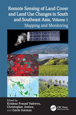
South and Southeast Asian countries are experiencing rapid land cover and land use changes (LCLUC) due to urbanization, agricultural expansion, deforestation, and infrastructure development. These changes have far-reaching consequences for biodiversity, water resources, food security, and climate regulation, underscoring the urgent need for effective monitoring and management strategies. Remote sensing data is essential for mapping and monitoring these changes. A variety of remote sensing data, ranging from coarse to very high resolution, can be used to assess land use patterns, and quantify changes.
Volume 1 showcases the practical utility of remote sensing data in various LCLUC studies. The book features contributions from the NASA-funded South/Southeast Asia Research Initiative and collaborators from multiple countries in South and Southeast Asia.
Key Features:
- Explores the latest methodologies, from deep learning to novel data integrations, for mapping LCLUC.
- Demonstrates case studies to monitor and map land cover changes using very-high, medium, and coarse-resolution satellite data.
- Highlights the role of remote sensing in integrating biophysical and socioeconomic data.
- Provides case studies on urban expansion, deforestation, and agricultural intensification.
- Demonstrates advanced remote sensing methods for tracking land use changes.
- Offers insights into sustainable land management using remote sensing and geospatial technologies.
This book serves as a cornerstone for advancing research and collaboration in the field of remote sensing and land use studies, particularly in South and Southeast Asia. It will be an invaluable resource for mapping and monitoring professionals, including remote sensing experts, geographers, environmental scientists, ecologists, and all others involved in land use/cover change research.
商品描述(中文翻譯)
南亞與東南亞國家正因都市化、農業擴張、森林砍伐及基礎設施開發,經歷快速的土地覆蓋與土地利用變化(land cover and land use changes, LCLUC)。這些變化對生物多樣性、水資源、糧食安全及氣候調節帶來深遠影響,也凸顯出制定有效監測與管理策略的迫切需求。遙測資料對於繪製及監測這些變化至關重要。從粗解析度到超高解析度的各類遙測資料,皆可用於評估土地利用模式並量化其變化。
第 1 卷展現遙測資料在各類土地覆蓋與土地利用變化(LCLUC)研究中的實際應用價值。本書收錄由 NASA 資助的南亞/東南亞研究倡議(South/Southeast Asia Research Initiative)及來自南亞與東南亞多個國家的合作研究人員所撰寫的內容。
主要特色:
• 探討用於繪製土地覆蓋與土地利用變化(LCLUC)的最新方法,包括深度學習及新型資料整合技術。
• 透過案例研究,示範如何利用超高解析度、中解析度及粗解析度衛星資料監測並繪製土地覆蓋變化。
• 強調遙測在整合生物物理資料與社會經濟資料方面所扮演的角色。
• 提供都市擴張、森林砍伐及農業集約化等主題的案例研究。
• 示範用於追蹤土地利用變化的進階遙測方法。
• 運用遙測與地理空間技術,提供永續土地管理方面的深入見解。
本書是推動遙測與土地利用研究領域研究及合作的重要基石,尤其適用於南亞與東南亞地區。對於從事繪圖與監測工作的專業人士而言,本書將是不可或缺的資源,適用讀者包括遙測專家、地理學家、環境科學家、生態學家,以及所有參與土地利用/覆蓋變化研究的人員。
作者簡介
Dr. Krishna Prasad Vadrevu is a remote sensing scientist at NASA's Marshall Space Flight Center in Huntsville, Alabama, USA. His research focuses on land cover and land use change (LCLUC), fire dynamics, and biomass burning emissions. With 25 years of experience in satellite remote sensing, he has an extensive publication record. He is the Deputy Program Manager for NASA's LCLUC Program and leads the South/Southeast Asia Research Initiative.
Dr. Christopher Justice is a Distinguished University Professor in the Department of Geographical Sciences at the University of Maryland, College Park, USA, with 45 years of experience in remote sensing research. He is a Project Scientist for the NASA LCLUC Program, the Land Discipline Lead for NASA MODIS, and a Suomi-NPP VIIRS Science Team member. Additionally, he is the Co-Chair of the GEO Global Agricultural Monitoring Initiative (GEOGLAM), Chief Scientist for NASA HARVEST, and Chair of the international Global Observations of Forest and Land Use Dynamics (GOFC-GOLD) program.
Dr. Garik Gutman is Program Manager for the NASA Land-Cover/Land-Use Change (LCLUC) Program. After 14 years of research on deriving land surface variables from satellite data at the National Oceanic and Atmospheric Administration (NOAA), he joined NASA Headquarters in 1999 and has been leading the LCLUC program, as well as Landsat-related activities, at NASA for over 25 years. He is the author of over 90 publications in peer-reviewed scientific journals and of several chapters in various climate- and land-cover related scientific volumes.
作者簡介(中文翻譯)
Krishna Prasad Vadrevu 博士是任職於美國阿拉巴馬州亨茲維爾 NASA Marshall Space Flight Center 的遙測科學家。他的研究重點包括土地覆蓋與土地利用變遷(land cover and land use change, LCLUC)、火災動態,以及生質燃燒排放。他具備 25 年的衛星遙測經驗,發表了大量研究成果。他目前擔任 NASA LCLUC 計畫的副計畫經理,並領導南亞/東南亞研究倡議(South/Southeast Asia Research Initiative)。
Christopher Justice 博士是美國 University of Maryland, College Park 地理科學系的特聘大學教授,並擁有 45 年的遙測研究經驗。他是 NASA LCLUC 計畫的專案科學家、NASA MODIS 的土地學科負責人,以及 Suomi-NPP VIIRS 科學團隊成員。此外,他也是 GEO 全球農業監測倡議(GEO Global Agricultural Monitoring Initiative, GEOGLAM)的共同主席、NASA HARVEST 的首席科學家,以及國際全球森林與土地利用動態觀測計畫(Global Observations of Forest and Land Use Dynamics, GOFC-GOLD)的主席。
Garik Gutman 博士是 NASA 土地覆蓋/土地利用變遷(Land-Cover/Land-Use Change, LCLUC)計畫的計畫經理。他曾在 National Oceanic and Atmospheric Administration(NOAA)從事 14 年利用衛星資料推導地表變數的研究,並於 1999 年加入 NASA Headquarters。此後,他在 NASA 領導 LCLUC 計畫及與 Landsat 相關的活動已超過 25 年。他在經同儕審查的科學期刊上發表了 90 多篇論文,並為多本與氣候及土地覆蓋相關的科學著作撰寫數個章節。