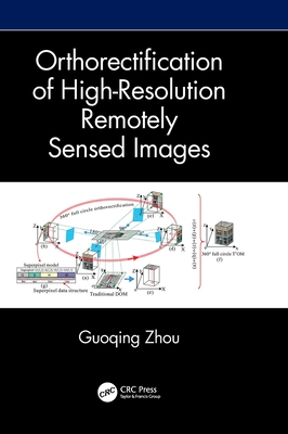
Orthorectification of High-Resolution Remotely Sensed Images
暫譯: 高解析度遙測影像正射校正
Zhou, Guoqing
- 出版商: CRC
- 出版日期: 2026-10-27
- 售價: $4,750
- 貴賓價: 9.5 折 $4,512
- 語言: 英文
- 頁數: 226
- 裝訂: Hardcover - also called cloth, retail trade, or trade
- ISBN: 1041052723
- ISBN-13: 9781041052722
-
相關分類:
地理資訊系統 Gis
尚未上市,無法訂購
商品描述
Ortho-rectification in remote sensing is used to correct satellite or aerial image distortions caused by terrain elevation and sensor angle. This book explains the ortho-rectification for different imaging methods such as frame, linear, and video imaging, for different imaged areas such as Greenland without ground features or urban areas with high buildings, for different types of sensors, and for different requirements of processing speed. It starts with the definition of ortho-rectification and takes a step-by-step introduction to the models, the algorithms, the methods, the Digital Orthophoto Map (DOM) quality control, and the USGS DOM Standards.
Features
- Focuses on a specific topic which is crucial for applications like land use mapping, urban planning, environmental monitoring, etc.
- Clearly explains the theory and the applications through many illustrations and detailed examples.
- Addresses ortho-rectification systematically and comprehensively for all levels of readers.
- Explains the challenges faced during constructing models, algorithms, and methods for ortho-rectification.
- Includes the lessons learned from the author's longstanding research and experience on the topic.
This book is an excellent reference for a complete understanding of ortho-rectification. It's for senior undergraduate students and graduate students in remote sensing, information technology, computer science and engineering, electronic engineering, and geography. As well as researchers, professionals, and those who work in governmental and commercial sectors interested in satellite remote sensing image processing.
商品描述(中文翻譯)
遙測中的正射校正(ortho-rectification)用於修正因地形高程與感測器角度所造成的衛星或航空影像變形。本書說明不同成像方式的正射校正,例如框幅成像、線陣列成像與視訊成像;不同影像區域的正射校正,例如缺乏地面特徵的 Greenland,或具有高樓大廈的都市區域;也涵蓋不同類型的感測器,以及不同處理速度需求下的正射校正。全書從正射校正的定義開始,逐步介紹相關模型、演算法、方法、數位正射影像圖(Digital Orthophoto Map,DOM)品質控制,以及 USGS DOM Standards。
特色
• 聚焦於一項對土地利用製圖、都市規劃、環境監測等應用至關重要的專門主題。
• 透過大量圖示與詳細範例,清楚說明相關理論與應用。
• 以系統化且全面的方式介紹各個讀者層級所需了解的正射校正內容。
• 說明在建構正射校正模型、演算法與方法時所面臨的挑戰。
• 納入作者長期研究與實務經驗中累積的重要心得。
本書是完整理解正射校正的優良參考書,適合遙測、資訊科技、電腦科學與工程、電子工程及地理學等領域的高年級大學生與研究生閱讀;也適合對衛星遙測影像處理感興趣的研究人員、專業人士,以及政府與商業部門從業人員。
作者簡介
Guoqing Zhou is a professor at the Guilin University of Technology, Guilin, China. He received his first PhD from Wuhan University, Wuhan, China, in 1994 and his second PhD from Virginia Tech at Blacksburg, Virginia, USA, in 2001. He was a visiting scholar at the Department of Computer Science and Technology, Tsinghua University, Beijing, China, and a postdoctoral researcher at the Institute of Information Science, Beijing Jiaotong University, Beijing, China, from 1994-1996. He continued his research as an Alexander von Humboldt Fellow at the Technical University of Berlin, Berlin, Germany, from 1997-1998 and afterward became a postdoctoral researcher at the Ohio State University, Columbus, OH, USA, from 1998 to 2000. Later he worked at Old Dominion University, Norfolk, VA, USA, as an assistant professor, associate professor, and full professor in 2000, 2005, and 2010, respectively. He has authored 14 books and has published more than 326 papers in peer-reviewed journals and 332 papers in conference proceedings.
作者簡介(中文翻譯)
Guoqing Zhou 是中國桂林桂林理工大學的教授。他於 1994 年在中國武漢的 Wuhan University 取得第一個博士學位,並於 2001 年在美國維吉尼亞州布萊克斯堡的 Virginia Tech 取得第二個博士學位。1994 至 1996 年間,他曾擔任中國北京 Tsinghua University 電腦科學與技術系的訪問學者,以及中國北京 Beijing Jiaotong University 資訊科學研究所的博士後研究員。1997 至 1998 年間,他以 Alexander von Humboldt Fellow 的身分,於德國柏林的 Technical University of Berlin 持續進行研究;之後於 1998 至 2000 年間,擔任美國俄亥俄州哥倫布 Ohio State University 的博士後研究員。2000 年起,他任職於美國維吉尼亞州諾福克的 Old Dominion University,先後於 2000 年、2005 年及 2010 年擔任助理教授、副教授及正教授。他著有 14 本書,並在同儕審查期刊發表超過 326 篇論文,在會議論文集發表 332 篇論文。