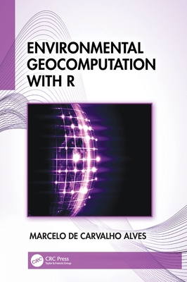
Environmental Geocomputation with R
暫譯: 使用 R 進行環境地理計算
de Carvalho Alves, Marcelo
- 出版商: CRC
- 出版日期: 2026-09-18
- 售價: $4,750
- 貴賓價: 9.5 折 $4,512
- 語言: 英文
- 頁數: 558
- 裝訂: Hardcover - also called cloth, retail trade, or trade
- ISBN: 1041208189
- ISBN-13: 9781041208181
-
相關分類:
地理資訊系統 Gis
海外代購書籍(需單獨結帳)
相關主題

商品描述
Environmental Geocomputation with R presents theoretical and practical principles for geospatial data analysis, visualization, and modeling, covering both the individual object approach and the continuous field approach. The book addresses spatial data uncertainties and error management while integrating spatial context into analytical results for better understanding of the environment. It progressively builds complexity enabling readers to develop geocomputational projects in the real world using algorithms and big data with R and its packages. The applications are focused on environmental and agricultural analyses, helping to incorporate spatial-temporal dimensions into decision-making processes.
Features
- Explains the theory and applications of geocomputational methods for solving environmental problems involving spatial data and analysis.
- Covers big data, machine learning, methods for pattern recognition in spatial data, and tools and data analytics in the free and open-source (FOSS) R platform, making them accessible to everyone.
- Includes case studies from different environments and explains the diversity of big data and its applications.
- Provides hands-on exercises at the end of each chapter and encourages readers to understand both the potential and limitations of environmental systems.
- Supplemented by a comprehensive laboratory manual with solved exercises, homework assignments, and research suggestions in geocomputation within an environmental science context.
This textbook is intended for students in upper-level undergraduate or graduate programs using GIS, geocomputation, geoprocessing in environmental sciences and engineering, surveying, geosciences, and agriculture engineering. It is also an excellent resource for professionals in different areas who use geocomputation and image processing and wish to develop their skillset in these areas.
商品描述(中文翻譯)
使用 R 進行環境地理計算介紹了地理空間數據分析、可視化和建模的理論和實踐原則,涵蓋了個別物件方法和連續場方法。該書探討了空間數據的不確定性和錯誤管理,同時將空間背景整合到分析結果中,以便更好地理解環境。它逐步增加複雜性,使讀者能夠使用 R 及其套件開發現實世界中的地理計算專案,並運用演算法和大數據。應用重點集中在環境和農業分析上,幫助將空間-時間維度納入決策過程中。
特色
- 解釋了地理計算方法的理論和應用,以解決涉及空間數據和分析的環境問題。
- 涵蓋大數據、機器學習、空間數據中的模式識別方法,以及在免費和開源 (FOSS) R 平台上的工具和數據分析,使其對所有人都可及。
- 包括來自不同環境的案例研究,並解釋大數據的多樣性及其應用。
- 在每章結尾提供實作練習,鼓勵讀者理解環境系統的潛力和限制。
- 附有全面的實驗室手冊,包含已解答的練習、作業和在環境科學背景下的地理計算研究建議。
本教科書適用於使用 GIS、地理計算、環境科學與工程中的地理處理、測量、地球科學和農業工程的高年級本科生或研究生課程。對於在不同領域使用地理計算和影像處理的專業人士來說,這也是一個極好的資源,幫助他們在這些領域發展技能。
作者簡介
Dr. Marcelo de Carvalho Alves is a professor of Remote Sensing and Geoprocessing at the Federal University de Lavras, Brazil. He received his PhD in 2006 in Agricultural Engineering from the Federal University of Lavras, Brazil. He has published in topography, remote sensing, and geoprocessing. He has over 25 years of extensive experience in data science, digital image processing and modeling using multiscale, multidisciplinary, multispectral and multitemporal concepts applied to different environments. Experimental field-sites include a tropical forest, savanna, wetland, and agricultural fields in Brazil. Over the years, he has built up a large portfolio of research grants mostly relating to agroecosystem management, broadly in the context of vegetation, soil, water, atmosphere, climate, and pest-organisms.
作者簡介(中文翻譯)
馬塞洛·德·卡瓦略·阿爾維斯博士是巴西拉夫拉斯聯邦大學的遙感與地理處理教授。他於2006年在巴西拉夫拉斯聯邦大學獲得農業工程博士學位。他在地形學、遙感和地理處理方面發表了多篇論文。他在數據科學、數位影像處理及建模方面擁有超過25年的豐富經驗,使用多尺度、多學科、多光譜和多時相的概念應用於不同環境。實驗場地包括巴西的熱帶森林、草原、濕地和農田。多年來,他積累了大量的研究經費,主要與農業生態系統管理有關,廣泛涉及植被、土壤、水、氣氛、氣候和害蟲生物的背景。