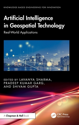
Artificial Intelligence in Geospatial Technology: Real-World Applications
暫譯: 地理空間技術中的人工智慧:真實世界應用
Sharma, Lavanya, Garg, Pradeep Kumar, Gupta, Shivam
- 出版商: CRC
- 出版日期: 2026-11-25
- 售價: $6,860
- 貴賓價: 9.5 折 $6,517
- 語言: 英文
- 頁數: 308
- 裝訂: Hardcover - also called cloth, retail trade, or trade
- ISBN: 1041235976
- ISBN-13: 9781041235972
-
相關分類:
地理資訊系統 Gis、Machine Learning、區塊鏈 Blockchain
尚未上市,無法訂購
相關主題

商品描述
This book provides an advanced overview of data acquisition, processing, and analysis using UAVs, LiDAR, GNSS, and 3D/4D GIS. It integrates AI, Blockchain, IoT, robotics, and cloud-native platforms into geospatial workflows for automation, predictive modeling, and real-time decision support. This book covers machine learning for spatial classification, blockchain for data integrity, and IoT-based sensor networks for scalable geospatial analytics.
- Emphasis is placed on open-source tools such as QGIS and PostGIS for cost-effective innovation, alongside advanced methods for infrastructure, mobility, and urban lifecycle management.
- Explains advanced data acquisition with UAVs, LiDAR, and GNSS for precise 3D/4D mapping, AI and ML applications for automated geospatial classification and predictive modeling.
- Discusses blockchain-enabled security, transparency, and decentralized geospatial transactions and IoT-driven real-time data collection and cloud-based spatial analytics.
- Includes integration of digital twins and BIM for infrastructure and urban management. Coverage of open-source platforms (QGIS, PostGIS, and OpenStreetMap) for scalable solutions.
- Includes case studies and system diagrams demonstrating smart city and industrial applications.
This book is for scholars, professionals, GIS analysts, urban planners, data scientists, engineers, researchers, and policymakers seeking expertise in AI-enabled geospatial intelligence and automation.
商品描述(中文翻譯)
本書深入介紹如何運用 UAV、LiDAR、GNSS 與 3D/4D GIS 進行資料擷取、處理與分析,並將 AI、Blockchain、IoT、robotics 與 cloud-native 平台整合至地理空間工作流程中,以實現自動化、預測建模與即時決策支援。本書涵蓋用於空間分類的 machine learning、確保資料完整性的 blockchain,以及以 IoT 為基礎的感測器網路,協助實現可擴充的地理空間分析。
• 著重介紹 QGIS 與 PostGIS 等 open-source 工具,以低成本實現創新;同時探討基礎設施、交通移動性與城市生命週期管理的進階方法。
• 說明運用 UAV、LiDAR 與 GNSS 進行精確 3D/4D 製圖的進階資料擷取技術,以及 AI 與 ML 在自動化地理空間分類和預測建模方面的應用。
• 討論 blockchain 所支援的安全性、透明度與去中心化地理空間交易,以及由 IoT 驅動的即時資料蒐集與雲端空間分析。
• 納入 digital twins 與 BIM 在基礎設施及城市管理中的整合應用,並介紹 QGIS、PostGIS 與 OpenStreetMap 等 open-source 平台,以建置可擴充的解決方案。
• 收錄案例研究與系統示意圖,展示智慧城市及工業領域的應用。
本書適合希望深入掌握 AI 驅動地理空間情報與自動化技術的學者、專業人士、GIS 分析師、都市規劃師、資料科學家、工程師、研究人員與政策制定者閱讀。
作者簡介
Dr. Lavanya Sharma received her Ph.D. (Computer Science) from Uttarakhand Technical University (State Government University), India in 2018, in the area of Image Processing & Computer Vision. She also received TEQIP scholarship for the same. She received her M.Tech (Computer Science) in 2013 from Maharshi Dayanand University, Haryana, India. She is currently working in NDIM as an Assistant Professor, Senior Research Team member. A certified professional 20 professional certificates. She is recipient of several prestigious awards and qualified certification courses from IIRS, ISRO Dehradun unit, India. She has 4 patents, 8 books (Authored & Edited) and over 70 research articles to her credit. Also acted as Organizing Committee Member, conference chair & Reviewer, in International conferences and Journal. She has developed various new courses and practical exercises in Computer Science Eng. Besides, supervising a large number of UG projects, she has guided more than 50 PG projects. She also acted as Examiner, Paper Setter of different universities in India. Her vision is to promote teaching & research, providing a highly competitive and productive environment in academic and research areas. Her primary research interests are Digital Image Processing and Computer Vision, Artificial Intelligence, Machine learning, deep learning, Internet of Things, Remote Sensing & GIS. Her vision is to promote teaching & research, providing a highly competitive and productive environment in academic and research areas with tremendous growing opportunities for the society and her country.
https: //www.researchgate.net/profile/Lavanya-Sharma-5
https: //scholar.google.com/citations?user=TqVT0B4AAAAJ&hl=en
Prof. P.K. Garg worked as a Vice Chancellor, Uttarakhand Technical University, Dehradun. Presently he is working in the Department of Civil Engineering, IIT Roorkee as an Emeritus Fellow. He has completed B.Tech (Civil Engg.) in 1980 and M.Tech (Civil Engg) in 1982 both from the University of Roorkee. He is a recipient of Gold Medal at IIT Roorkee to stand first during M.Tech programme, Commonwealth Scholarship Award for doing Ph.D. from University of Bristol (UK), and Commonwealth Fellowship Award to carry out PostDoc at University of Reading (UK). He is instrumental in prestigious MHRD funded projects on e-learning; Development of Virtual Labs, Pedagogy and courses under NPTEL. He has served as experts on various national committees, including Ministry of Environment & Forest, EAEC Committee, NBA and Project Evaluation Committee, DST, New Delhi. He has organized 10 conferences, workshop and published over 300 technical papers in conferences and journals. He has undertaken 26 research projects and provided technical services to 83 consultancy projects. He has authored and edited 9 books, guided about 74 M.Tech and 30 Ph.D. thesis and produced 2 technical films on Story of Mapping. Considering the need to train the human resource in the country, he has successfully organized 44 programmes in advanced areas of Photogrammetry, Remote Sensing, GIS and GPS.
Https: //Www.Researchgate.Net/Profile/Pradeep-Garg-4
Https: //Scholar.Google.Co.In/Citations?User=Ys_F33saaaaj&Hl=En
Shivam Gupta is the Senior Regional Business Manager for the Survey Solutions division at Hexagon Geosystems, leading the Global Sales region in Asia. With a proven track record in business strategy, market expansion, and sales leadership, he drives the growth of Hexagon's Survey Solutions portfolio, which includes Total Stations, GNSS, Monitoring Solutions, and advanced geospatial software and solutions. Since joining Leica Geosystems in 2014, Shivam has played a pivotal role in shaping product strategy, spearheading business development, and leading high-impact initiatives across product management, division management, sales, marketing, support. His deep industry expertise stems from prior roles in product engineering and applications at Topcon and Nikon, where he gained hands-on experience in geospatial technologies. Shivam holds an Engineering degree in Information Technology, an MBA in Strategy & Marketing from the Indian Institute of Management, Lucknow (India), and has further honed his leadership acumen through the LEAD program at Stanford Graduate School of Business. A strategic thinker and market disruptor, he is passionate about leveraging technology to transform the geospatial industry and drive sustainable business growth.
https: //www.linkedin.com/in/beingskg/
作者簡介(中文翻譯)
Lavanya Sharma 博士於 2018 年取得印度 Uttarakhand Technical University(邦立大學)的博士學位(Computer Science),研究領域為影像處理(Image Processing)與電腦視覺(Computer Vision),並獲得同年度的 TEQIP 獎學金。她於 2013 年取得印度 Haryana 邦 Maharshi Dayanand University 的 M.Tech(Computer Science)學位。目前,她任職於 NDIM,擔任助理教授及資深研究團隊成員。她是一名通過認證的專業人士,持有 20 項專業證書。她曾獲得多項知名獎項,並完成由 IIRS、ISRO Dehradun unit, India 所提供的認證課程。她擁有 4 項專利、8 本著作(包括作者及編者),並發表超過 70 篇研究論文。此外,她也曾擔任國際會議與期刊的籌備委員會成員、大會主席及審稿人。她在 Computer Science Engineering 領域開發了多門新課程與實作練習。除了指導大量大學部專題外,她也指導過 50 多項研究所專題。她還曾擔任印度不同大學的考官及命題委員。她的願景是推動教學與研究,在學術及研究領域提供高度競爭力且富有成效的環境。她的主要研究興趣包括數位影像處理(Digital Image Processing)、電腦視覺(Computer Vision)、人工智慧(Artificial Intelligence)、機器學習(Machine Learning)、深度學習(Deep Learning)、物聯網(Internet of Things)、遙感(Remote Sensing)與 GIS。她的願景是在學術及研究領域推動教學與研究,提供高度競爭力且富有成效的環境,為社會與國家創造蓬勃發展的機會。
https: //www.researchgate.net/profile/Lavanya-Sharma-5
https: //scholar.google.com/citations?user=TqVT0B4AAAAJ&hl=en
P.K. Garg 教授曾任 Uttarakhand Technical University, Dehradun 的副校長。目前,他任職於 IIT Roorkee 土木工程系,擔任榮譽研究員。他於 1980 年及 1982 年分別取得 University of Roorkee 的 B.Tech(土木工程)與 M.Tech(土木工程)學位。在 M.Tech 課程期間名列第一,他獲得 IIT Roorkee 頒發的金牌;此外,他也曾獲得 Commonwealth Scholarship Award,赴 University of Bristol(UK)攻讀博士學位,以及 Commonwealth Fellowship Award,赴 University of Reading(UK)進行博士後研究。
他參與了多項由 MHRD 資助的重要計畫,包括電子學習(e-learning)、虛擬實驗室(Virtual Labs)的開發,以及 NPTEL 旗下的教學法與課程開發。他曾擔任多個國家級委員會的專家,包括 Ministry of Environment & Forest、EAEC Committee、NBA,以及 DST, New Delhi 的 Project Evaluation Committee。他曾籌辦 10 場會議與工作坊,並在會議及期刊上發表超過 300 篇技術論文。他主持了 26 項研究計畫,並為 83 項顧問計畫提供技術服務。他撰寫及編輯了 9 本書,指導約 74 篇 M.Tech 論文與 30 篇博士論文,並製作了 2 部關於地圖製作歷史(Story of Mapping)的技術影片。考量到國家對人才培訓的需求,他曾成功籌辦 44 項涵蓋攝影測量(Photogrammetry)、遙感(Remote Sensing)、GIS 與 GPS 等先進領域的培訓計畫。
Https: //Www.Researchgate.Net/Profile/Pradeep-Garg-4
Https: //Scholar.Google.Co.In/Citations?User=Ys_F33saaaaj&Hl=En
Shivam Gupta 是 Hexagon Geosystems Survey Solutions 部門的資深區域業務經理,負責領導亞洲全球銷售區域。憑藉在商業策略、市場拓展與銷售領導方面的優異實績,他負責推動 Hexagon Survey Solutions 產品組合的成長,該產品組合包括全站儀(Total Stations)、GNSS、監測解決方案(Monitoring Solutions),以及先進的地理空間軟體與解決方案。
自 2014 年加入 Leica Geosystems 以來,Shivam 在產品策略制定、業務開發,以及產品管理、部門管理、銷售、行銷與支援等領域的高影響力計畫中,扮演了關鍵角色。他深厚的產業專業知識,源自於過去在 Topcon 與 Nikon 擔任產品工程及應用職務時,所累積的地理空間技術實務經驗。
Shivam 擁有 Information Technology 工程學位,以及印度 Lucknow 的 Indian Institute of Management 所授予的策略與行銷 MBA 學位;此外,他也透過 Stanford Graduate School of Business 的 LEAD program,進一步培養領導能力。他是一名具備策略思維且勇於顛覆市場的專業人士,熱衷於運用技術轉型地理空間產業,並推動企業永續成長。
https: //www.linkedin.com/in/beingskg/