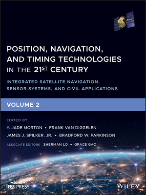
Position, Navigation, and Timing Technologies in the 21st Century: Integrated Satellite Navigation, Sensor Systems, and Civil Applications, Volume 2
暫譯: 21世紀定位、導航與時間技術:整合衛星導航、感測系統與民用應用,第二卷
Morton, Y. Jade, Van Diggelen, Frank, Spilker, James J., Jr.
- 出版商: Wiley
- 出版日期: 2021-01-13
- 售價: $6,960
- 貴賓價: 9.5 折 $6,612
- 語言: 英文
- 頁數: 896
- 裝訂: Hardcover - also called cloth, retail trade, or trade
- ISBN: 1119458498
- ISBN-13: 9781119458494
-
相關分類:
Raspberry Pi
海外代購書籍(需單獨結帳)
商品描述
Covers the latest developments in PNT technologies, including integrated satellite navigation, sensor systems, and civil applications
Featuring sixty-four chapters that are divided into six parts, this two-volume work provides comprehensive coverage of the state-of-the-art in satellite-based position, navigation, and timing (PNT) technologies and civilian applications. It also examines alternative navigation technologies based on other signals-of-opportunity and sensors and offers a comprehensive treatment on integrated PNT systems for consumer and commercial applications.
Volume 1 of Position, Navigation, and Timing Technologies in the 21st Century: Integrated Satellite Navigation, Sensor Systems, and Civil Applications contains three parts and focuses on the satellite navigation systems, technologies, and engineering and scientific applications. It starts with a historical perspective of GPS development and other related PNT development. Current global and regional navigation satellite systems (GNSS and RNSS), their inter-operability, signal quality monitoring, satellite orbit and time synchronization, and ground- and satellite-based augmentation systems are examined. Recent progresses in satellite navigation receiver technologies and challenges for operations in multipath-rich urban environment, in handling spoofing and interference, and in ensuring PNT integrity are addressed. A section on satellite navigation for engineering and scientific applications finishes off the volume.
Volume 2 of Position, Navigation, and Timing Technologies in the 21st Century: Integrated Satellite Navigation, Sensor Systems, and Civil Applications consists of three parts and addresses PNT using alternative signals and sensors and integrated PNT technologies for consumer and commercial applications. It looks at PNT using various radio signals-of-opportunity, atomic clock, optical, laser, magnetic field, celestial, MEMS and inertial sensors, as well as the concept of navigation from Low-Earth Orbiting (LEO) satellites. GNSS-INS integration, neuroscience of navigation, and animal navigation are also covered. The volume finishes off with a collection of work on contemporary PNT applications such as survey and mobile mapping, precision agriculture, wearable systems, automated driving, train control, commercial unmanned aircraft systems, aviation, and navigation in the unique Arctic environment.
In addition, this text:
- Serves as a complete reference and handbook for professionals and students interested in the broad range of PNT subjects
- Includes chapters that focus on the latest developments in GNSS and other navigation sensors, techniques, and applications
- Illustrates interconnecting relationships between various types of technologies in order to assure more protected, tough, and accurate PNT
Position, Navigation, and Timing Technologies in the 21st Century: Integrated Satellite Navigation, Sensor Systems, and Civil Applications will appeal to all industry professionals, researchers, and academics involved with the science, engineering, and applications of position, navigation, and timing technologies.
pnt21book.com
商品描述(中文翻譯)
涵蓋最新的 PNT 技術發展,包括整合衛星導航、感測器系統和民用應用
本書由六個部分組成,共有六十四章,提供了基於衛星的定位、導航和定時(PNT)技術及其民用應用的最新狀態的全面介紹。它還探討了基於其他機會信號和感測器的替代導航技術,並對消費者和商業應用的整合 PNT 系統進行了全面的處理。
《21 世紀的定位、導航和定時技術:整合衛星導航、感測器系統和民用應用》的第一卷包含三個部分,重點介紹衛星導航系統、技術以及工程和科學應用。它首先回顧了 GPS 發展及其他相關 PNT 發展的歷史背景。當前的全球和區域導航衛星系統(GNSS 和 RNSS)、它們的互操作性、信號質量監控、衛星軌道和時間同步,以及地面和衛星增強系統都得到了檢視。最近在衛星導航接收器技術方面的進展,以及在多徑豐富的城市環境中運行的挑戰、處理欺騙和干擾的問題,以及確保 PNT 完整性的挑戰也得到了討論。最後一部分專注於工程和科學應用的衛星導航。
《21 世紀的定位、導航和定時技術:整合衛星導航、感測器系統和民用應用》的第二卷由三個部分組成,探討使用替代信號和感測器的 PNT 以及針對消費者和商業應用的整合 PNT 技術。它考察了使用各種無線機會信號、原子鐘、光學、激光、磁場、天體、MEMS 和慣性感測器的 PNT 應用,以及來自低地球軌道(LEO)衛星的導航概念。GNSS-INS 整合、導航的神經科學和動物導航也在其中涵蓋。該卷的最後收錄了當代 PNT 應用的相關工作,如測量和移動測繪、精準農業、可穿戴系統、自動駕駛、列車控制、商業無人機系統、航空和在獨特的北極環境中的導航。
此外,本書:
- 作為專業人士和學生的完整參考和手冊,涵蓋廣泛的 PNT 主題
- 包含專注於 GNSS 和其他導航感測器、技術和應用的最新發展的章節
- 說明各種技術之間的相互關係,以確保更安全、堅固和準確的 PNT
《21 世紀的定位、導航和定時技術:整合衛星導航、感測器系統和民用應用》將吸引所有從事定位、導航和定時技術科學、工程和應用的行業專業人士、研究人員和學者。
pnt21book.com
作者簡介
Y. JADE MORTON, PHD is a Professor at Ann and H. J. Smead Aerospace Engineering Sciences Department, University of Colorado at Boulder. Her research interests lie at the intersection of satellite navigation and remote sensing of the space environment, atmosphere, and Earth surface. She has led numerous research projects sponsored by AFOSR, AFRL, DARPA, NASA, NSF, ONR, and private industries. Dr. Morton is the President of the Institute of Navigation (ION), a fellow of IEEE, ION, and the Royal Institute of Navigation (RIN, UK).
FRANK VAN DIGGELEN, PHD is a Principal Engineer at Google, where he leads the Android Core-Location Team. He also teaches at Stanford University. He is the inventor of coarse-time GNSS navigation, co-inventor of Long Term Orbits for A-GNSS, and the author of "A-GPS" the first textbook on Assisted GNSS. He is Executive Vice President of the Institute of Navigation (ION) and a Fellow of the ION and the Royal Institute of Navigation (UK).
JAMES J. SPILKER, JR., PHD was a Consulting Professor in the Aeronautics and Astronautics Department at Stanford University. Dr. Spilker was an elected member of the National Academy of Engineering, a Life Fellow of the IEEE, and a Fellow of the Institute of Navigation (ION). As one of the originators of GPS, James Spilker shared the Goddard Memorial Trophy and the Queen Elizabeth Prize for Engineering.
BRADFORD W. PARKINSON, PHD is an Edward C. Wells Professor of Aeronautics and Astronautics Emeritus at Stanford University. Dr. Parkinson was the Chief Architect for GPS, led the original advocacy and development for the system, and served as the first Director of the GPS Joint Program Office. He has been the CEO of two companies and serves on many boards. Among his many awards are the IEEE Medal of Honor, the Draper Prize of the National Academy of Engineering, and the Queen Elizabeth Prize for Engineering.
作者簡介(中文翻譯)
Y. JADE MORTON, PHD 是科羅拉多大學博爾德分校安與H.J. Smead航空工程科學系的教授。她的研究興趣位於衛星導航與太空環境、大氣及地球表面的遙感交匯處。她曾主導多個由AFOSR、AFRL、DARPA、NASA、NSF、ONR及私營產業贊助的研究項目。Morton博士是導航學會(ION)的會長,並且是IEEE、ION及英國皇家導航學會(RIN)的會士。
FRANK VAN DIGGELEN, PHD 是Google的首席工程師,負責領導Android核心定位團隊。他同時在史丹佛大學任教。他是粗時間GNSS導航的發明者,A-GNSS的長期軌道的共同發明者,以及《A-GPS》這本第一本有關輔助GNSS的教科書的作者。他是導航學會(ION)的執行副會長,並且是ION及英國皇家導航學會的會士。
JAMES J. SPILKER, JR., PHD 曾是史丹佛大學航空與太空科學系的顧問教授。Spilker博士是美國國家工程院的當選成員,IEEE的終身會士,以及導航學會(ION)的會士。作為GPS的創始人之一,James Spilker曾分享戈達德紀念獎和伊莉莎白女王工程獎。
BRADFORD W. PARKINSON, PHD 是史丹佛大學的愛德華C. 威爾斯航空與太空科學榮譽教授。Parkinson博士是GPS的首席架構師,主導該系統的最初倡導與開發,並擔任GPS聯合計畫辦公室的首任主任。他曾擔任兩家公司的CEO,並在多個董事會任職。他獲得的眾多獎項包括IEEE榮譽獎、國家工程院的德雷珀獎,以及伊莉莎白女王工程獎。






![Jump Start HTML5 [Paperback]-cover](https://cf-assets2.tenlong.com.tw/products/images/000/082/450/medium/51Yom4I3lSL.jpg?1525643135)
