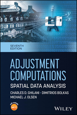
Adjustment Computations: Spatial Data Analysis
暫譯: 調整計算:空間數據分析
Ghilani, Charles D., Bolkas, Dimitrios, Olsen, Michael J.
- 出版商: Wiley
- 出版日期: 2026-06-23
- 售價: $5,990
- 貴賓價: 9.5 折 $5,690
- 語言: 英文
- 頁數: 800
- 裝訂: Hardcover - also called cloth, retail trade, or trade
- ISBN: 1394341318
- ISBN-13: 9781394341313
-
相關分類:
地理資訊系統 Gis
海外代購書籍(需單獨結帳)
相關主題

商品描述
Provides Comprehensive, Up-to-Date Guidance on Spatial Data Accuracy
As modern surveying, mapping, and geospatial technologies continue to evolve, the need for precise data adjustment and error analysis has never been greater. Adjustment Computations: Spatial Data Analysis, Seventh Edition, remains the definitive guide to understanding, applying, and mastering least squares and related techniques that ensure the accuracy of spatial datasets.
This updated edition integrates advances in spatial technologies, with new chapters covering laser scanning, point cloud processing, and parametric model estimation. Updated discussions of ASPRS standards, NSRS updates, and current computational tools reflect the latest professional practices and technologies. The text maintains its clear, pedagogical structure with concise chapters, worked examples, and practical software applications. Providing the analytical tools to deliver high-quality spatial data for diverse applications, this book:
- Includes coverage of laser scanning and its errors, point cloud shape fitting, GNSS networks, coordinate transformations, and parametric modeling
- Incorporates updated standards from ASPRS and the National Spatial Reference System (NSRS)
- Provides access to companion software, MathCAD worksheets, and video lessons for hands-on problem solving
- Balances rigorous mathematics with accessible explanations and real-world surveying applications
- Features real-world case studies of infrastructure documentation, construction, and environmental monitoring
Ideal for undergraduate and graduate courses in surveying, geomatics, and geospatial analysis, Adjustment Computations: Spatial Data Analysis, Seventh Edition, supports curricula in civil engineering, geosciences, and GIS programs. It is also a useful reference for professional surveyors and geospatial analysts seeking to enhance data accuracy and reliability.
商品描述(中文翻譯)
提供全面且最新的空間數據準確性指導
隨著現代測量、製圖和地理空間技術的不斷演進,對於精確數據調整和誤差分析的需求從未如此迫切。調整計算:空間數據分析,第七版,仍然是理解、應用和掌握最小二乘法及相關技術以確保空間數據集準確性的權威指南。
本次更新的版本整合了空間技術的最新進展,新增章節涵蓋激光掃描、點雲處理和參數模型估計。更新的ASPRS標準、NSRS更新和當前計算工具的討論反映了最新的專業實踐和技術。該文本保持清晰的教學結構,包含簡潔的章節、實例和實用的軟體應用。提供分析工具以交付高品質的空間數據以應用於多種場景,本書:
- 涵蓋激光掃描及其誤差、點雲形狀擬合、GNSS網絡、坐標轉換和參數建模
- 納入ASPRS和國家空間參考系統(NSRS)的更新標準
- 提供配套軟體、MathCAD工作表和視頻課程以進行實作問題解決
- 在嚴謹的數學與易於理解的解釋及現實世界的測量應用之間取得平衡
- 展示基礎設施文檔、建設和環境監測的實際案例研究
本書非常適合用於測量、地理資訊學和地理空間分析的本科及研究生課程,調整計算:空間數據分析,第七版,支持土木工程、地球科學和GIS課程的教學大綱。對於希望提高數據準確性和可靠性的專業測量師和地理空間分析師來說,這也是一本有用的參考書。
作者簡介
CHARLES D. GHILANI is a Professor Emeritus of Engineering at Pennsylvania State University and an award-winning authority on surveying and geodesy.
DIMITRIOS BOLKAS is an Associate Professor of Surveying Engineering at Pennsylvania State University, specializing in laser scanning and GNSS networks.
MICHAEL J. OLSEN is the CH2M Hill Professor of Civil Engineering at Oregon State University and a leader in geomatics and 3D laser scanning applications.
作者簡介(中文翻譯)
**查爾斯·D·吉拉尼**(CHARLES D. GHILANI)是賓夕法尼亞州立大學的名譽工程教授,並且是測量學和大地測量學的獲獎權威。
**迪米特里奧斯·博卡斯**(DIMITRIOS BOLKAS)是賓夕法尼亞州立大學的測量工程副教授,專注於激光掃描和全球導航衛星系統(GNSS)網絡。
**邁克爾·J·奧爾森**(MICHAEL J. OLSEN)是俄勒岡州立大學的CH2M Hill土木工程教授,並且是地理資訊科學和3D激光掃描應用的領導者。