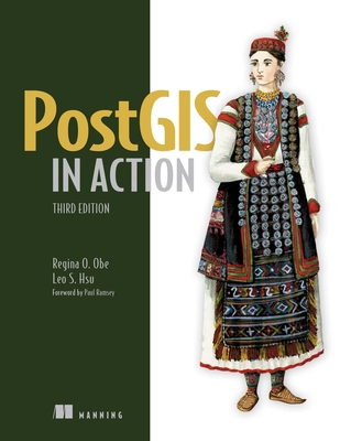
PostGIS in Action, 2/e (Paperback)
暫譯: PostGIS 實戰 (第二版)
Regina O. Obe, Leo S. Hsu
- 出版商: Manning
- 出版日期: 2015-05-03
- 售價: $1,810
- 貴賓價: 9.5 折 $1,720
- 語言: 英文
- 頁數: 600
- 裝訂: Paperback
- ISBN: 1617291390
- ISBN-13: 9781617291395
-
相關分類:
地理資訊系統 Gis
-
其他版本:
Postgis in Action, 3/e (Paperback)
買這商品的人也買了...
-
 大話設計模式
$620$490 -
 重構─改善既有程式的設計, 2/e (Refactoring: Improving The Design of Existing Code)
$800$632 -
 鳥哥的 Linux 私房菜-伺服器架設篇, 3/e
$800$632 -
 無瑕的程式碼 - 敏捷軟體開發技巧守則 (Clean Code: A Handbook of Agile Software Craftsmanship)
$580$452 -
 9-99 歲電腦我也會
$350$298 -
 中老年人快樂學電腦:Office 2013 (Word / Excel / PowerPoint / Outlook)<超大圖解好閱讀,教學影片好上手>
$420$332 -
 ASP.NET MVC 5 網站開發美學
$780$616 -
 You Don't Know JS: Async & Performance (Paperback)
$1,070$1,017 -
 精通 Python|運用簡單的套件進行現代運算 (Introducing Python: Modern Computing in Simple Packages)
$780$616 -
 完整學會 Git, GitHub, Git Server 的24堂課
$360$284 -
 鳥哥的 Linux 私房菜-基礎學習篇, 4/e
$980$774 -
 Geoprocessing with Python(Paperback)
$1,800$1,710 -
Android 高效入門>>深度學習-使用 Android Studio 2 開發 Android 6.0 APP
$650$507 -
 9-99 歲電腦我也會-Windows 10 輕鬆上手
$350$298 -
 超圖解 Arduino 互動設計入門, 3/e
$680$578 -
 Python 自動化的樂趣|搞定重複瑣碎 & 單調無聊的工作 (中文版) (Automate the Boring Stuff with Python: Practical Programming for Total Beginners)
$500$425 -
深度學習快速入門 — 使用 TensorFlow (Getting started with TensorFlow)
$360$180 -
 演算法技術手冊, 2/e (Algorithms in a Nutshell: A Practical Guide, 2/e)
$580$458 -
 $594揭秘 Angular 2
 -
 圖解雲端技術|基礎架構x運作原理 x API
$480$379 -
 優化 C++|提高程式效能的有效技術 (Optimized C++: Proven Techniques for Heightened Performance)
$680$578 -
 TensorFlow + Keras 深度學習人工智慧實務應用
$590$460 -
 Soft Skills 軟實力|軟體開發人員的生存手冊 (Soft Skills: The software developer's life manual)
$520$411 -
 Docker 這樣學才有趣:從入門,到玩直播、挖礦
$450$225 -
 為你自己學 Git
$500$390
相關主題
商品描述
PostGIS is an open source spatial database extender for PostgreSQL. It equals or surpasses proprietary alternatives, allowing the creations of location-aware queries with just a few lines of SQL code, and provides a back-end for mapping, raster analysis, and routing applications with minimal effort.
PostGIS in Action, Second Edition teaches readers of all levels to write spatial queries that solve real-world problems. After covering the background in vector, raster and topology based GIS, it quickly moves into analyzing, viewing, and mapping data. The book shows how to optimize queries for maximum speed, simplify geometries for greater efficiency, analyze rasters, vectorize rasters, better manage data utilizing topologies, and create custom functions for applications. It covers PostGIS 2.0 and 2.1 series, PostgreSQL 9.1- 9.3 features and shows how to integrate with other GIS tools.
Purchase of the print book includes a free eBook in PDF, Kindle, and ePub formats from Manning Publications.
商品描述(中文翻譯)
PostGIS 是一個開源的空間資料庫擴展工具,專為 PostgreSQL 設計。它的功能等同或超越專有替代方案,僅需幾行 SQL 代碼即可創建位置感知查詢,並為地圖繪製、光柵分析和路由應用提供後端支持,所需的努力最小。
《PostGIS in Action, Second Edition》教導各級讀者撰寫解決現實世界問題的空間查詢。在介紹了基於向量、光柵和拓撲的地理資訊系統(GIS)背景後,書中迅速進入數據的分析、查看和繪圖。這本書展示了如何優化查詢以達到最大速度,簡化幾何形狀以提高效率,分析光柵,將光柵向量化,更好地利用拓撲管理數據,並為應用創建自定義函數。它涵蓋了 PostGIS 2.0 和 2.1 系列、PostgreSQL 9.1-9.3 的特性,並展示了如何與其他 GIS 工具集成。
購買印刷版書籍可獲得 Manning Publications 提供的免費 PDF、Kindle 和 ePub 格式電子書。


