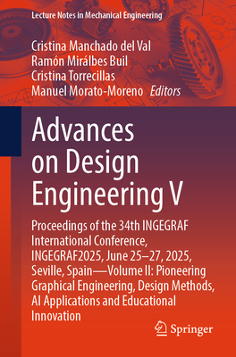
Advances on Design Engineering V: Proceedings of the 34th Ingegraf International Conference, Ingegraf2025, June 25-27, 2025, Seville, Spain--Volume II
暫譯: 設計工程進展 V:第34屆 Ingegraf 國際會議論文集,Ingegraf2025,2025年6月25-27日,西班牙塞維利亞--第二卷
Manchado del Val, Cristina, Mirálbes Buil, Ramón, Torrecillas, Cristina
相關主題

商品描述
商品描述(中文翻譯)
這是包含於第34屆INGEGRAF國際會議所提交論文的第二卷,會議將於6月25日至27日在西班牙塞維利亞舉行。除了報告產品設計和製造的前沿主題外,還提供了創新設計和電腦輔助設計的見解。其他涵蓋的主題包括虛擬模擬和逆向工程;增材製造;產品製造;醫學和教育中的工程方法;表現技術;工程和建設的進展以及相關的工具和方法論;以及航空和航天設計與建模。本書分為五個主題部分,全面反映了會議的核心焦點領域。除了為研究人員、工程師和專家提供廣泛的日常工作資訊外,這裡所呈現的貢獻也將激發新的研究方向、所討論方法的先進應用,以及未來在各種工業工程子領域中研究人員、工程師和專家之間的跨學科合作。
作者簡介
Manuel Morato Moreno
Manuel Morato Moreno is an architect who graduated from the University of Seville's School of Architecture, specializing in Urban Planning and earning a Ph.D. in Architecture. Since 1991, he has led his own practice, working on projects of various scales in architecture and urban design.
He began his academic career in 1993 as an Associate Professor in the Department of Design Engineering and later joined the Graphic Engineering Department. He has held leadership roles including department secretary (2017-2019) and director since 2019. He teaches across several engineering disciplines, including Aerospace, Agronomic, Civil, Industrial, Robotics, and Chemical Engineering.
His research focuses on historical cartography, especially terrain and relief representation in the 16th century. Over the past 15 years, he has published in international journals, served as a reviewer, and participated in doctoral committees across Europe.
Cristina Torrecillas
Cristina Torrecillas holds a Bachelor's in Geodesy and Cartography Engineering from the Polytechnic University of Valencia and a Ph.D. in Geodesy and Geophysics from the University of Cadiz. She has been an Associate Professor at the University of Seville's Higher Technical School of Engineering since 2004.
Her research includes detecting changes on the Earth's surface for geospatial data updates using machine learning, GIS, GNSS, UAVs, laser scanning, and space-time analysis. She also studies hydrological and coastal geomorphology and gazetteer management. Her work has been published in international journals and presented at global conferences. Since 2019, she has led the research group "Geospatial, Graphical, and Hydrological Information Technologies."
Ramon Miralbes
Ramon Miralbes is a Professor in the Department of Design and Manufacturing at the University of Zaragoza, where he has worked since 2005. He holds an M.S. in Industrial Engineering and a Ph.D. in New Materials in Automotive Engineering, focusing on cryogenic trailer design.
He has held visiting roles at the Universities of Leuven, Porto, and Newcastle. His research spans Finite Element Method applications in mechanical, thermal, and fluid dynamics, additive manufacturing, mechanical testing, minimal surface structures, and eco-friendly materials. He has led and contributed to projects under the 7th Framework Programme, Horizon Europe, and over 40 industrial collaborations. He has authored 40+ JCR-indexed publications and presented at 70+ conferences. Since 2017, he has served on the INGEGRAF board--vice-president until 2021, and president since.
Cristina Manchado
Cristina Manchado is an Associate Professor in the Department of Geographic Engineering and Graphic Expression Techniques at the University of Cantabria. She has been part of the EgiCAD R&D group since 2002 and earned her Ph.D. in Civil Engineering in 2015.
Her research focuses on Visual Impact Assessment for civil infrastructures, Spatial Analysis, and GIS, but recently, she has concentrated on Building Information Modeling (BIM) in construction project management. She also works with emerging technologies such as extended reality, IoT, and digital twins. She has authored over 25 indexed publications, presented at more than 50 conferences, and led or collaborated on 20+ projects with companies and institutions.
作者簡介(中文翻譯)
**Manuel Morato Moreno**
Manuel Morato Moreno 是一位建築師,畢業於塞維利亞大學建築學院,專攻城市規劃並獲得建築學博士學位。自1991年以來,他一直領導自己的事務所,參與各種規模的建築和城市設計項目。
他於1993年開始學術生涯,擔任設計工程系的副教授,後來加入圖形工程系。他曾擔任部門秘書(2017-2019)及自2019年以來的系主任。他教授多個工程學科,包括航空航天、農業、土木、工業、機器人和化學工程。
他的研究重點是歷史地圖學,特別是16世紀的地形和地貌表現。在過去的15年中,他在國際期刊上發表文章,擔任審稿人,並參與歐洲的博士委員會。
**Cristina Torrecillas**
Cristina Torrecillas 擁有瓦倫西亞理工大學的測量與地圖工程學士學位,以及卡迪斯大學的測量與地球物理學博士學位。自2004年以來,她一直擔任塞維利亞大學高等技術工程學院的副教授。
她的研究包括利用機器學習、地理資訊系統(GIS)、全球導航衛星系統(GNSS)、無人機(UAV)、激光掃描和時空分析來檢測地球表面的變化,以更新地理空間數據。她還研究水文和海岸地貌以及地名管理。她的工作已在國際期刊上發表並在全球會議上報告。自2019年以來,她領導著「地理空間、圖形和水文信息技術」研究小組。
**Ramon Miralbes**
Ramon Miralbes 是薩拉戈薩大學設計與製造系的教授,自2005年以來一直在該校工作。他擁有工業工程碩士學位和汽車工程新材料博士學位,專注於低溫拖車設計。
他曾在魯汀根大學、波爾圖大學和紐卡斯爾大學擔任訪問職位。他的研究涵蓋有限元素法在機械、熱和流體動力學中的應用、增材製造、機械測試、最小表面結構和環保材料。他曾主導和參與第七框架計劃、地平線歐洲以及超過40個工業合作項目。他已發表40多篇JCR索引的出版物,並在70多個會議上報告。自2017年以來,他一直擔任INGEGRAF董事會成員,至2021年為副主席,之後擔任主席。
**Cristina Manchado**
Cristina Manchado 是坎塔布里亞大學地理工程與圖形表達技術系的副教授。自2002年以來,她一直是EgiCAD研發小組的一員,並於2015年獲得土木工程博士學位。
她的研究專注於土木基礎設施的視覺影響評估、空間分析和GIS,但最近她將重點放在建築信息建模(BIM)在建設項目管理中的應用。她還與擴增實境、物聯網(IoT)和數位雙胞胎等新興技術合作。她已發表超過25篇索引出版物,並在50多個會議上報告,還主導或參與了20多個與公司和機構的項目。