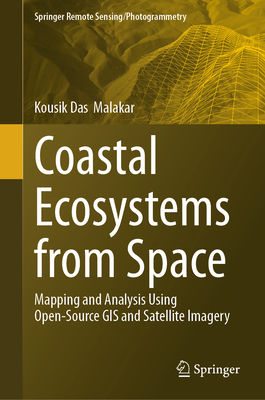
Coastal Ecosystems from Space: Mapping and Analysis Using Open-Source GIS and Satellite Imagery
暫譯: 從太空觀察沿海生態系統:使用開源GIS和衛星影像的映射與分析
Malakar, Kousik Das
- 出版商: Springer
- 出版日期: 2026-07-16
- 售價: $8,390
- 貴賓價: 9.5 折 $7,970
- 語言: 英文
- 頁數: 528
- 裝訂: Hardcover - also called cloth, retail trade, or trade
- ISBN: 3032268273
- ISBN-13: 9783032268273
-
相關分類:
地理資訊系統 Gis
海外代購書籍(需單獨結帳)
相關主題


商品描述
商品描述(中文翻譯)
本書提供了一個全面且易於理解的沿海生態系統監測與管理的介紹,使用開源遙感數據和地理資訊系統(GIS),並強調社區參與和可持續性。內容分為三個相互關聯的部分,從基礎概念到應用分析,最後到新興技術,提供從基本理解到實際實施及進一步創新的清晰邏輯進展。
第一部分介紹了沿海遙感和開源GIS的概念及技術基礎,重點關注關鍵沿海生態系統組件的光譜特徵,並概述了改善衛星數據質量的預處理技術。它還介紹了開放存取的地理空間數據庫,並解釋了如何使用開放GIS平台整合多樣的數據集。第二部分進入實際應用,專注於使用開源遙感數據和GIS工具(如QGIS、SAGA GIS、Google Earth Engine和GRASS GIS)進行沿海地圖製作和分析方法。它呈現了土地使用變化和棲息地動態、地表溫度趨勢、沿海植被的時空光譜分析、樹冠水分和氮含量、土壤成分、沿海農業環境評估、沿海城市景觀動態、海岸線變化檢測及動態,以及紅樹林的動態與管理等案例研究。本部分還明確強調了參與式GIS方法,關注公民科學、原住民知識和協作GIS在提高數據可靠性和支持更具包容性的沿海治理中的貢獻,並通過實際案例進行說明。最後一部分突出了新興趨勢,如物聯網(IoT)驅動的監測、基於雲的地理空間處理、基於網絡的決策支持系統和公民驅動的環境追蹤。
本書在理論與應用之間架起了橋樑,支持基於證據的政策,並為研究人員、實踐者、決策者、科學家、專業人士、學生及沿海研究愛好者提供可及的工具和框架,以應對當前的沿海挑戰,促進韌性和可持續的沿海未來。
作者簡介
Dr. Kousik Das Malakar is a socio-ecological geographer, GIS analyst, and researcher with a specialization in climate change and policy. He currently holds the position of Assistant Professor in the Department of Geography, GDC Memorial College (affiliated to the Chaudhary Bansi Lal University, Bhiwani), BRCM Vidyagram Campus, Haryana. Dr. Malakar earned his Ph.D. from the Department of Geography, Central University of Haryana, Mahendergarh. He also possesses a master's degree in social science geography from Jawaharlal Nehru University (JNU), New Delhi, and a bachelor's degree from Vidyasagar University, Medinipur, West Bengal. His research interests encompass the climate crisis, coastal socio-ecological systems, water governance, environments and societies, sustainability, disaster studies, participatory policy planning, and the application of geospatial technologies. In his field of research, Dr. Malakar has participated in over 150 academic events and has authored and edited 07 books published by Springer Nature, Emerald Publishing, Palgrave Macmillan and other reputed publishers. Dr. Malakar has published more than 50 research papers, conference proceedings, book chapters, general articles, and reports in nationally and internationally reputed publications. He has supervised more than 20 postgraduate project reports. He has received numerous certifications from the Indian Institute of Remote Sensing (IIRS) in Dehradun, the Geological Survey of India (GSI) in Hyderabad, and the National Institute of Disaster Management (NIDM) in New Delhi, recognizing his ability to engage in and acquire research ideas and knowledge. Additionally, he actively serves as a reviewer for academic journals and books, and is a member of several academic and professional organizations, including Academic Counsellor at IGNOU New Delhi, Human Development and Capability Association (USA), Unequal World (USA), the International Society for Urban Health (USA), the International Centre of Excellence in Engineering & Technology (Portugal), and the International Centre of Excellence in Humanities, Social Sciences, and Interdisciplinary Studies (Portugal).
作者簡介(中文翻譯)
Dr. Kousik Das Malakar 是一位社會生態地理學家、GIS 分析師及研究員,專門研究氣候變遷及政策。他目前擔任哈里亞納邦 BRCM Vidyagram 校區 GDC Memorial College 地理系的助理教授(隸屬於 Chaudhary Bansi Lal University, Bhiwani)。Malakar 博士在哈里亞納中央大學的地理系獲得博士學位。他還擁有新德里 Jawaharlal Nehru University (JNU) 社會科學地理碩士學位,以及西孟加拉邦 Medinipur 的 Vidyasagar University 學士學位。他的研究興趣包括氣候危機、沿海社會生態系統、水治理、環境與社會、可持續性、災害研究、參與式政策規劃及地理空間技術的應用。在他的研究領域中,Malakar 博士參加了超過 150 個學術活動,並且著作及編輯了 7 本由 Springer Nature、Emerald Publishing、Palgrave Macmillan 等知名出版社出版的書籍。Malakar 博士已在國內外知名出版物上發表了超過 50 篇研究論文、會議論文、書籍章節、一般文章及報告。他指導了超過 20 份研究生專案報告。他獲得了來自德拉敦的印度遙感研究所 (IIRS)、海德拉巴的印度地質調查局 (GSI) 及新德里的國家災害管理研究所 (NIDM) 的多項認證,這些認證表彰了他在研究理念及知識獲取方面的能力。此外,他還積極擔任學術期刊及書籍的審稿人,並且是多個學術及專業組織的成員,包括新德里 IGNOU 的學術顧問、美國人類發展與能力協會、美國不平等世界、國際城市健康協會、美國、葡萄牙工程與技術卓越國際中心,以及葡萄牙人文、社會科學及跨學科研究卓越國際中心。