Urban Observation and Social Sensing
暫譯: 城市觀察與社會感知
Chen, Bin, Zhang, Fan
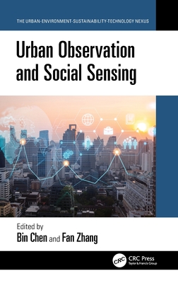
- 出版商: CRC
- 出版日期: 2026-08-06
- 售價: $5,120
- 貴賓價: 9.5 折 $4,864
- 語言: 英文
- 頁數: 168
- 裝訂: Hardcover - also called cloth, retail trade, or trade
- ISBN: 1032776536
- ISBN-13: 9781032776538
-
相關分類:
地理資訊系統 Gis
海外代購書籍(需單獨結帳)
相關主題


商品描述
Urban Observation and Social Sensing helps readers see cities in a way they have seldom imagined before. Advanced technologies such as satellites in space, near surface drones, or even smartphones, can be used to explain how a city functions, or why certain areas are more populated than others. It examines the science of capturing city images and information gathered from above the ground combined with the information from social media and mobile data on the ground, and how to make sense of it all. From planning better neighborhoods to understanding how city life affects health, this book is a guide to the future of urban living and the technologies that help navigate it.
Features
- Covers a broad spectrum of urban observation methods in one resource to ensure a thorough understanding of diverse data collection methods.
- Provides a unique emphasis on social sensing to enable a more holistic and human-centric view of urban landscapes.
- Includes practical applications to showcase how the data and methodologies can be used in real-world scenarios.
- Explains the current technologies and methodologies but also offers insights into the future trajectory of urban science.
- Integrates technological advances with informed urban planning and real-time insights to elucidate a holistic understanding of urban spaces.
This is an excellent, insightful resource for researchers, academics, students, and professionals in remote sensing, Geographic Information Systems, urban planning and design, data science, geography, earth science, and those interested in the future of urban living and planning.
商品描述(中文翻譯)
《城市觀察與社會感知》幫助讀者以一種前所未有的方式看待城市。先進的技術,如太空中的衛星、近地表的無人機,甚至智能手機,都可以用來解釋城市的運作方式,或為什麼某些區域的人口密度高於其他區域。這本書探討了如何從空中捕捉城市影像和信息,並結合來自社交媒體和地面移動數據的信息,並解釋如何理解這一切。從規劃更好的社區到理解城市生活如何影響健康,這本書是未來城市生活及其導航技術的指南。
特色
- 涵蓋廣泛的城市觀察方法,確保對多樣數據收集方法的全面理解。
- 獨特強調社會感知,以便對城市景觀提供更全面和以人為本的視角。
- 包含實際應用,展示數據和方法論如何在現實場景中使用。
- 解釋當前的技術和方法論,並提供對城市科學未來發展的見解。
- 將技術進步與知情的城市規劃和實時見解相結合,以闡明對城市空間的整體理解。
這是一本出色且富有洞察力的資源,適合從事遙感、地理信息系統、城市規劃與設計、數據科學、地理學、地球科學的研究人員、學者、學生和專業人士,以及對未來城市生活和規劃感興趣的人士。
作者簡介
Dr. Bin Chen is an Associate Professor, Director of Future Urbanity & Sustainable Environment (FUSE) Lab at The University of Hong Kong. He obtained his BSc in Geographical Information Systems from Wuhan University, and his PhD in Global Environmental Change from Beijing Normal University. Before joining the University of Hong Kong in 2021, he worked as a postdoctoral researcher at the University of California, Davis.
Dr. Chen's research leverages geospatial big data, data-model fusion, and advanced interdisciplinary approaches to investigate the interaction loops between environmental change, human activities, and public health. Specifically, his major research includes the remote sensing of built and natural environmental changes; modelling of human-environment spatiotemporal interaction; and impact of environment and human activities on public health. He has published over 80 refereed publications in top academic journals. His achievements have received international recognition, including Geospatial World 50 Rising Stars (2024) and receiving the International Society of Digital Earth Young Scientist Award, American Association of Geographers Early Career Award in Remote Sensing, and HKU-100 Scholars Award and Outstanding Young Researcher Award.
Dr. Fan Zhang is an Assistant Professor at the Institute of Remote Sensing and GIS, Peking University. Prior to this, he was a Senior Research Fellow at MIT, where he led the Urban Visual AI group at the MIT Senseable City Lab. His research focuses on geographical artificial intelligence and data-driven urban studies, with particular emphasis on developing urban visual intelligence using street-level imagery. Dr. Zhang's work has been published in renowned academic journals, and he currently serves as an Associate Editor and Editorial Board Member for various journals. He currently serves as an Associate Editor, an Editorial Board Member. His notable honors include the CPGIS Young Scholar Award (2024), the Geospatial World 50 Rising Stars Award (2022), and the Global Young Scientist Award in Frontier Science and Technology from WGDC (2020).
作者簡介(中文翻譯)
陳彬博士是香港大學未來城市與可持續環境(FUSE)實驗室的副教授及主任。他在武漢大學獲得地理資訊系統的學士學位,並在北京師範大學獲得全球環境變化的博士學位。在2021年加入香港大學之前,他曾在加州大學戴維斯分校擔任博士後研究員。
陳博士的研究利用地理空間大數據、數據模型融合及先進的跨學科方法,探討環境變化、人類活動與公共健康之間的互動循環。具體而言,他的主要研究包括建成環境和自然環境變化的遙感;人類與環境的時空互動建模;以及環境和人類活動對公共健康的影響。他在頂尖學術期刊上發表了超過80篇經過審核的論文。他的成就獲得國際認可,包括2024年地理空間世界50位新星(Geospatial World 50 Rising Stars)及獲得國際數位地球學會青年科學家獎、美國地理學會遙感早期職業獎,以及香港大學100位學者獎和傑出青年研究者獎。
張凡博士是北京大學遙感與地理資訊系的助理教授。在此之前,他曾是麻省理工學院的高級研究員,並在麻省理工學院可感知城市實驗室領導城市視覺人工智慧小組。他的研究專注於地理人工智慧和數據驅動的城市研究,特別強調利用街景影像開發城市視覺智能。張博士的研究成果已發表於知名學術期刊,並目前擔任多個期刊的副編輯及編輯委員會成員。他的顯著榮譽包括2024年CPGIS青年學者獎、2022年地理空間世界50位新星獎,以及2020年WGDC前沿科學與技術全球青年科學家獎。