Thematic Cartography and Geovisualization
暫譯: 主題地圖學與地理視覺化
Slocum, Terry, McMaster, Robert B., Kessler, Fritz
- 出版商: CRC
- 出版日期: 2026-08-11
- 售價: $5,450
- 貴賓價: 9.5 折 $5,177
- 語言: 英文
- 頁數: 658
- 裝訂: Hardcover - also called cloth, retail trade, or trade
- ISBN: 1041033753
- ISBN-13: 9781041033752
-
相關分類:
地理資訊系統 Gis
海外代購書籍(需單獨結帳)
相關主題

商品描述
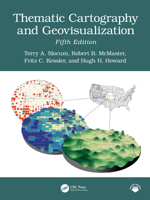
The fifth edition of this comprehensive and well-established book in cartography has been thoroughly updated and extensively restructured to incorporate new developments in recent years. It reflects advancements in technology, societal changes, and evolving methodologies in the field of cartography. With the inclusion of entirely new chapters, restructured content, and expanded discussions, the book provides a modern perspective on cartographic practices. It emphasizes the integration of Artificial Intelligence, the democratization of mapping through web-based tools, and innovative approaches to visualizing spatiotemporal data. Additionally, it addresses historical paradigms, geovisual analytics, and the adaptation of map elements and typography for mobile and web platforms, ensuring relevance in today's digital age.
Some Key Features of the Fifth Edition
- Artificial Intelligence in Cartography: A new chapter explores AI's 75-year history, deep learning, cartographic applications, and ethical implications.
- Maps, Mapping, and Society: A new chapter highlights the democratization of map-making through web-based tools, empowering the general public.
- History of Thematic Mapping: Restructured to cover American cartographic paradigms, including analytical, design and production, education, statistical mapping, and symbolization.
- Visualizing Spatiotemporal Data: Formerly "Animation," this chapter now includes alternatives such as change maps, small multiples, and space-time cubes.
- Geovisual Analytics: Expanded to include the Australian Cancer Atlas and dashboard development.
- Map Elements and Typography: Expanded to include guidelines for mobile devices and web browsers.
- Elements of Map Projections: Now discusses the Universal Transverse Mercator (UTM) and State Plane Coordinate System (SPCS) grid systems.
商品描述(中文翻譯)
第五版的這本全面且歷史悠久的地圖學書籍已進行徹底更新和廣泛重組,以納入近年來的新發展。它反映了技術進步、社會變遷以及地圖學領域不斷演變的方法論。書中包含全新章節、重組內容和擴展討論,提供了對地圖製作實踐的現代視角。它強調了人工智慧的整合、透過網路工具實現地圖製作的民主化,以及創新的時空數據可視化方法。此外,書中還探討了歷史範式、地理可視化分析,以及為移動和網路平台調整地圖元素和字體,以確保在當今數位時代的相關性。
第五版的一些主要特點:
- 人工智慧在地圖學中的應用:新章節探討了人工智慧75年的歷史、深度學習、地圖學應用及其倫理影響。
- 地圖、製圖與社會:新章節強調透過網路工具實現地圖製作的民主化,賦予大眾權力。
- 主題地圖的歷史:重組內容涵蓋美國地圖學範式,包括分析、設計與製作、教育、統計製圖及符號化。
- 時空數據可視化:原本的「動畫」章節現在包括變更地圖、小多重圖和時空立方體等替代方案。
- 地理可視化分析:擴展內容包括澳大利亞癌症地圖集和儀表板開發。
- 地圖元素與字體:擴展內容包括針對移動設備和網頁瀏覽器的指導方針。
- 地圖投影的元素:現在討論了通用橫軸墨卡托(UTM)和州平面坐標系(SPCS)網格系統。
作者簡介
Terry A. Slocum is an Emeritus Professor with the University of Kansas where he taught cartography and statistics for 35 years and chaired the Department of Geography for eight years. He has published in a variety of acclaimed academic journals in cartography, geography, and geoscience. Professor Slocum has been affiliated with six grants from the U.S. National Science Foundation and received two Teacher Appreciation Awards from the Center for Teaching Excellence at the University of Kansas.
Robert B. McMaster is professor in the Department of Geography, Environment, and Society at the University of Minnesota. He has authored or edited seven books, and his papers have been published in an array of academic journals. Professionally, he served as President of the Cartography and Geographic Information Society (CaGIS), President of the University Consortium for GIS (UCGIS), and as a Vice President of the International Cartographic Association (ICA). He served a three-year term on the National Research Council's (NRC) Mapping Science Committee and a six-year term on the NRC's Board on Earth Sciences. He has been named a Fellow of ACSM and UCGIS.
Fritz C. Kessler is a professor in the Department of Geography at Penn State University. He has published in many highly acclaimed academic journals. He has co-authored Working with Map Projections: A Guide to their Selection with Dr. Sarah Battersby, also published by CRC Press. Professor Kessler currently serves on the Editorial Board for Cartographic Perspectives. He was past President of the North American Cartographic and Information Society, a Board of Director for Cartography and Geographic Information Science and the North American Cartographic Information Society, and Editor of Cartographic Perspectives.
Hugh H. Howard is a professor of GIS at American River College in Sacramento, California. He earned his Ph.D. in Geography from the University of Kansas specializing in cartographic design and developed an expert system software application to aid students in designing better maps. He has won an Excellence in Education award from the California Geographic Information Association (CGIA), and a Lifetime Achievement in Geospatial Two-Year College Education award from the GeoTech Center. Hugh has worked as a cartographer for the U.S. Forest Service, the City of San Francisco, CB Richard Ellis, and Cartographics. He also taught GIS and managed GIS labs at Stanford University and San Francisco State University.
作者簡介(中文翻譯)
Terry A. Slocum 是堪薩斯大學的名譽教授,他在該校教授製圖學和統計學達35年,並擔任地理系主任八年。他在製圖學、地理學和地球科學等多個知名學術期刊上發表過文章。Slocum教授曾參與六項美國國家科學基金會的計畫,並獲得堪薩斯大學教學卓越中心頒發的兩項教師表彰獎。
Robert B. McMaster 是明尼蘇達大學地理、環境與社會系的教授。他著作或編輯了七本書籍,並在多個學術期刊上發表過論文。在專業上,他曾擔任製圖與地理資訊學會(CaGIS)會長、地理資訊系統大學聯盟(UCGIS)會長,以及國際製圖協會(ICA)副會長。他在國家研究委員會(NRC)的製圖科學委員會任職三年,並在NRC的地球科學委員會任職六年。他被授予美國地理學會(ACSM)和UCGIS的院士。
Fritz C. Kessler 是賓州州立大學地理系的教授。他在許多高度評價的學術期刊上發表過文章。他與Dr. Sarah Battersby共同撰寫了Working with Map Projections: A Guide to their Selection,該書同樣由CRC Press出版。Kessler教授目前擔任《Cartographic Perspectives》的編輯委員會成員。他曾擔任北美製圖與資訊學會的會長,並擔任製圖與地理資訊科學的董事會成員,以及《Cartographic Perspectives》的編輯。
Hugh H. Howard 是加州薩克拉門托美國河學院的GIS教授。他在堪薩斯大學獲得地理學博士學位,專攻製圖設計,並開發了一個專家系統軟體應用程式,以幫助學生設計更好的地圖。他曾獲得加州地理資訊協會(CGIA)的教育卓越獎,以及GeoTech Center頒發的地理空間兩年制大學教育終身成就獎。Hugh曾在美國森林服務局、舊金山市、CB Richard Ellis和Cartographics擔任製圖師。他還在史丹佛大學和舊金山州立大學教授GIS並管理GIS實驗室。