相關主題


商品描述
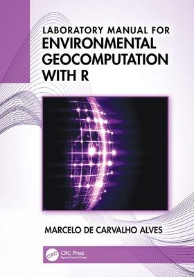
This Laboratory Manual complements the textbook Environmental Geocomputation with R, featuring practical applications for natural resource data analysis through hands-on exercises and case studies using the open-source R platform. Its structured workflow enhances students' understanding of scientific approaches to each case study, teaching them to replicate, adapt, and expand methodologies with new datasets, models, and research areas. Designed for both undergraduate and graduate students in environmental, agricultural, and social sciences, it provides a comprehensive foundation in computational environmental analysis while developing transferable skills in data manipulation and visualization.
Features
- Aims to expand theoretical approaches of environmental geocomputation through multidisciplinary applications using R and R packages.
- Engages students in learning theory through hands-on real-life projects.
- All chapters are structured with solved exercises and homework and encourage readers to understand the potential and the limitations of the environments.
- Covers data analysis in free and open-source (FOSS) R platform, which makes geocomputation accessible to anyone with a computer.
- Explores current trends and developments in geocomputation in homework assignments with CBERS-4A, GADM, WorldClim, ESA WorldCover, SRTM, GEE, climate change CMIP6 models, Black Marble, AppEEARS, GPW UN-adjusted Population, MODIS, OpenStreetMap, and COVID-19 data to further explore the use of free applications and geoprocessing concerns.
The lab manual is intended for students in upper-level undergraduate or graduate programs using GIS, Geocomputation, Geoprocessing in environmental sciences and engineering, surveying, geosciences, and agriculture engineering. It is also an excellent resource for professionals in different areas who use geocomputation and image processing and wish to develop their skillset in these areas.
商品描述(中文翻譯)
這本實驗手冊是教科書《環境地理計算與 R》的補充,透過實作練習和案例研究,提供自然資源數據分析的實際應用,並使用開源的 R 平台。其結構化的工作流程增強了學生對每個案例研究的科學方法的理解,教導他們如何使用新的數據集、模型和研究領域來複製、調整和擴展方法論。該手冊專為環境、農業和社會科學的本科生和研究生設計,提供計算環境分析的全面基礎,同時培養數據處理和可視化的可轉移技能。
特色
- 旨在通過使用 R 和 R 套件的多學科應用擴展環境地理計算的理論方法。
- 透過實際的真實項目讓學生參與學習理論。
- 所有章節均結構化為已解決的練習和作業,鼓勵讀者理解環境的潛力和限制。
- 涵蓋在免費和開源 (FOSS) R 平台上的數據分析,使地理計算對任何擁有電腦的人都可及。
- 在作業中探索地理計算的當前趨勢和發展,使用 CBERS-4A、GADM、WorldClim、ESA WorldCover、SRTM、GEE、氣候變化 CMIP6 模型、Black Marble、AppEEARS、GPW UN 調整人口、MODIS、OpenStreetMap 和 COVID-19 數據,進一步探索免費應用程序的使用和地理處理的問題。
該實驗手冊適用於使用 GIS、地理計算、環境科學和工程、測量、地球科學及農業工程的高年級本科生或研究生。對於在不同領域使用地理計算和影像處理的專業人士來說,這也是一個極好的資源,幫助他們在這些領域發展技能。
作者簡介
Dr. Marcelo de Carvalho Alves is a professor of Remote Sensing and Geoprocessing at the Federal University de Lavras, Brazil. He received his PhD in 2006 in Agricultural Engineering from the Federal University of Lavras, Brazil. He has published in topography, remote sensing, and geoprocessing. He has over 25 years of extensive experience in data science, digital image processing and modeling using multiscale, multidisciplinary, multispectral and multitemporal concepts applied to different environments. Experimental field-sites include a tropical forest, savanna, wetland, and agricultural fields in Brazil. Over the years, he has built up a large portfolio of research grants mostly relating to agroecosystem management, broadly in the context of vegetation, soil, water, atmosphere, climate, and pest-organisms.
作者簡介(中文翻譯)
馬塞洛·德·卡瓦略·阿爾維斯博士是巴西拉夫拉斯聯邦大學的遙感與地理處理教授。他於2006年在巴西拉夫拉斯聯邦大學獲得農業工程博士學位。他在地形學、遙感和地理處理方面發表了多篇論文。他在數據科學、數位影像處理及建模方面擁有超過25年的豐富經驗,使用多尺度、多學科、多光譜和多時相的概念應用於不同環境。實驗場地包括巴西的熱帶森林、草原、濕地和農田。多年來,他積累了大量的研究經費,主要與農業生態系統管理有關,廣泛涉及植被、土壤、水、氣氛、氣候和害蟲生物的背景。





![研究所 2024 試題大補帖【熱力學與流體力學】(110~112年試題)[適用臺大、清大、陽明交通、成大、中央、中正、中山、北科大研究所考試]-cover](https://cf-assets2.tenlong.com.tw/products/images/000/195/458/medium/9786263276482.jpg?1698290522)


