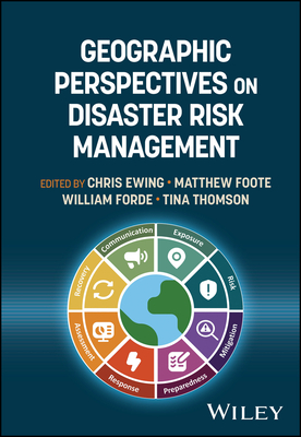
Geographic Perspectives on Disaster Risk Management
暫譯: 災害風險管理的地理視角
Ewing, Chris, Foote, Matthew, Forde, William
- 出版商: Wiley
- 出版日期: 2026-08-24
- 售價: $3,820
- 貴賓價: 9.5 折 $3,629
- 語言: 英文
- 頁數: 464
- 裝訂: Hardcover - also called cloth, retail trade, or trade
- ISBN: 1119751446
- ISBN-13: 9781119751441
-
相關分類:
地理資訊系統 Gis
海外代購書籍(需單獨結帳)
相關主題


商品描述
A holistic view of geospatial data and analysis across the risk management lifecycle
Geospatial data and analytical tools are widely used for disaster management, insurance, humanitarian response, and defence--yet methodologies remain siloed. Geographic Perspectives on Disaster Risk Management, written by a team of experienced practitioners in catastrophe risk analytics and geospatial studies, connects these sectors by comparing approaches, identifying common challenges, and distilling cross-sector best practices for preparation, response, recovery, and mitigation.
Structured around the disaster risk cycle, the book addresses exposure and vulnerability mapping, risk preparedness and mitigation strategies, event monitoring, damage assessment, resilience building, and risk communication. It draws on data sources ranging from local traffic cameras to geostationary satellites and includes case studies illustrating real-world applications alongside outcome-based evaluations of current practices and future developments in disaster risk assessment.
Readers will also find:
- Cross-sector comparison of methodologies from international development, emergency response, insurance, defence, and commercial geospatial analytics
- Practical case studies demonstrating real-world challenges and solutions in disaster preparation, monitoring, damage assessment, and recovery operations
- Outcome-based evaluation of common approaches to emergency risk management, identifying strengths and limitations of current practice
- Coverage of future developments in data availability, analytical techniques, and climate risk assessment relevant to evolving environmental uncertainty
- Guidance on risk communication and decision-making frameworks that translate geospatial analysis into actionable operational and financial strategies
Designed for professionals in disaster management, emergency response, and the insurance industry, as well as researchers and advanced students in the geosciences, this book provides a structured, practice-oriented resource for applying geographic perspectives to quantify, communicate, and reduce disaster risk across sectors.
商品描述(中文翻譯)
風險管理生命週期中地理空間數據與分析的整體觀
地理空間數據和分析工具廣泛應用於災害管理、保險、人道主義應對和國防等領域,然而方法論仍然存在孤島現象。《地理視角下的災害風險管理》,由一群在災害風險分析和地理空間研究方面具有豐富經驗的專業人士撰寫,通過比較不同領域的方法、識別共同挑戰,並提煉跨領域的最佳實踐,將這些領域聯繫起來,以便於準備、應對、恢復和減輕風險。
本書圍繞災害風險循環結構,探討了暴露和脆弱性映射、風險準備和減輕策略、事件監測、損害評估、韌性建設和風險溝通。它利用的數據來源從當地交通攝像頭到靜止衛星,並包括案例研究,說明現實世界的應用以及基於結果的當前實踐和未來災害風險評估的發展。
讀者還將發現:
- 來自國際發展、緊急應對、保險、國防和商業地理空間分析的跨領域方法比較
- 實用案例研究,展示災害準備、監測、損害評估和恢復操作中的現實挑戰和解決方案
- 基於結果的評估,分析應急風險管理的常見方法,識別當前實踐的優勢和局限性
- 涵蓋與不斷變化的環境不確定性相關的數據可用性、分析技術和氣候風險評估的未來發展
- 有關風險溝通和決策框架的指導,將地理空間分析轉化為可行的操作和財務策略
本書旨在為災害管理、緊急應對和保險行業的專業人士,以及地球科學領域的研究人員和高級學生提供結構化、以實踐為導向的資源,以應用地理視角來量化、溝通和減少各領域的災害風險。
作者簡介
CHRIS EWING is Head of Business Development for Impact Forecasting, the catastrophe model development centre of Aon. He has 20 years' experience across risk management, (re)insurance, engineering, and humanitarian sectors. He holds a BSc in Physical Geography and an MSc in Geographical Information Science. Chris is a Chartered Geographer (GIS) from the Royal Geographical Society and a co-founder and Chair of the Disaster Risk Management Professional Practice Group.
MATTHEW FOOTE has over 30 years' experience in insurance, disaster risk financing, cartography, earth observation, and catastrophe risk analytics. He serves as UK Principal Representative to the GEO Programme Board and was the first chair of the GRMA Strategic Advisory Board. He is a fellow of the Royal Geographical Society and a co-founder of its Disaster Risk Management Professional Practice Group.
WILLIAM FORDE is a specialist in geospatial analytics and catastrophe risk. Drawing on senior leadership experience at global consulting firms and a leading GIS vendor, he helps insurers and regulators translate complex data into actionable insights for hazard management and resilience. He holds an MSc in Remote Sensing and a BA in Anthropology and Geogaphy from University College London and is a Fellow of the Royal Geographical Society, where he co-founded its Disaster Risk Management Professional Practice Group.
TINA THOMSON, PHD, has held senior leadership roles in analytics, research, and digital solutions spanning a career across Catastrophe Model Vendors, Property & Casualty Insurance, Reinsurance, and Reinsurance Brokers. Tina is passionate about the application of scientific concepts, emerging industry trends and new technologies. She holds a PhD in Geomatic Engineering from University College London. She is a Fellow of the Remote Sensing and Photogrammetry Society and a Chartered Geographer with the Royal Geographical Society, where she co-founded the Professional Practice Group for Disaster Risk Management.
作者簡介(中文翻譯)
**克里斯·尤因 (CHRIS EWING)** 是 Aon 的災害模型開發中心 Impact Forecasting 的業務發展負責人。他在風險管理、(再)保險、工程和人道主義領域擁有 20 年的經驗。他擁有物理地理學學士學位和地理資訊科學碩士學位。克里斯是英國皇家地理學會的特許地理學家 (GIS),並且是災害風險管理專業實踐小組的共同創始人和主席。
**馬修·福特 (MATTHEW FOOTE)** 在保險、災害風險融資、製圖、地球觀測和災害風險分析方面擁有超過 30 年的經驗。他擔任英國 GEO 計劃委員會的主要代表,並且是 GRMA 戰略諮詢委員會的首任主席。他是英國皇家地理學會的會員,也是其災害風險管理專業實踐小組的共同創始人。
**威廉·福德 (WILLIAM FORDE)** 是地理空間分析和災害風險的專家。憑藉在全球諮詢公司和領先 GIS 供應商的高層領導經驗,他幫助保險公司和監管機構將複雜數據轉化為可行的見解,以進行危害管理和增強韌性。他擁有倫敦大學學院的遙感碩士學位和人類學及地理學的學士學位,並且是英國皇家地理學會的會員,曾共同創立其災害風險管理專業實踐小組。
**蒂娜·湯姆森 (TINA THOMSON, PHD)** 在分析、研究和數位解決方案方面擔任過高層領導職位,職業生涯涵蓋災害模型供應商、財產與意外保險、再保險及再保險經紀人。蒂娜對科學概念的應用、新興行業趨勢和新技術充滿熱情。她擁有倫敦大學學院的測繪工程博士學位。她是遙感與攝影測量學會的會員,並且是英國皇家地理學會的特許地理學家,曾共同創立災害風險管理專業實踐小組。