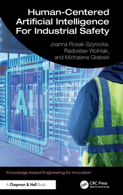
Geospatial Innovations in Disaster Management: An Overview of Recent Developments
暫譯: 災害管理中的地理空間創新:近期發展概述
Van Westen, Cees J., Van Den Homberg, Marc J. C., Kerle, Norman
- 出版商: Springer
- 出版日期: 2026-10-26
- 售價: $2,710
- 貴賓價: 9.5 折 $2,574
- 語言: 英文
- 頁數: 128
- 裝訂: Hardcover - also called cloth, retail trade, or trade
- ISBN: 303211831X
- ISBN-13: 9783032118318
-
相關分類:
地理資訊系統 Gis、Machine Learning
海外代購書籍(需單獨結帳)
相關主題

商品描述
商品描述(中文翻譯)
當我們面對日益頻繁且複雜的災害時,地理空間資訊在有效的災害管理中扮演著核心角色。
本開放取用書籍全面探討空間資料、尖端科技與創新方法如何徹底改變我們準備、應對及從災害中復原的方式。從遙測與人工智慧,到社群媒體監測與地理健康(geohealth)應用,本書展示地理空間創新如何重塑災害管理週期的每個階段。透過清楚的說明、真實世界案例研究與實用工具,引導讀者理解從多重災害風險評估到影響導向預測等各項概念。
本書專為災害管理、地理學與地理資訊學領域的專業人士、研究人員及學生所設計,致力於連結理論與實務。除了凸顯空間技術的潛力,也批判性地檢視其限制、倫理挑戰與未來發展方向。透過將資料驅動的方法與人道需求相互連結,本書提供讀者所需的知識,使其能夠善用地理空間資訊,面對不斷演變的災害威脅,打造更具韌性的社會。
作者簡介
Cees van Westen is a professor in Multi-Hazard Risk Dynamics at the Faculty of Geo-Information Science and Earth Observation (ITC), University of Twente, the Netherlands. His research and teaching focus on the use of geospatial information for multi-hazard risk assessment, vulnerability analysis, and disaster risk reduction. He has led numerous international projects and capacity-building initiatives, supporting governments, NGOs, and academic institutions in strengthening disaster resilience worldwide.
Marc van den Homberg is the Lead Data Scientist at 510, the data and digital initiative of the Netherlands Red Cross, and a researcher affiliated with the University of Twente. His work focuses on data-driven humanitarian action, including impact-based forecasting, early warning systems, and anticipatory disaster response. He has pioneered innovative approaches that combine geospatial information, artificial intelligence, and humanitarian expertise to improve decision-making in crisis situations.
Norman Kerle is a professor at the Faculty of Geo-Information Science and Earth Observation (ITC), University of Twente, the Netherlands. His expertise lies in the use of remote sensing, UAVs, and artificial intelligence for disaster damage assessment and risk reduction. He has extensive experience in international research and field projects, advancing innovative geospatial methods to support emergency response and recovery efforts.
Catherine Nabukulu is a researcher affiliated with the Faculty of Geo-Information Science and Earth Observation (ITC) at the University of Twente in the Netherlands, focusing on natural hazards, climate-related risks, and geospatial analysis. Her research includes studying the spatial-temporal variability of tropical cyclone rainfall and its implications for flood hazard assessment using satellite data and hydrological modelling.
作者簡介(中文翻譯)
Cees van Westen 是荷蘭特文特大學地理資訊科學與地球觀測學院(ITC)多重災害風險動態領域的教授。他的研究與教學著重於運用地理空間資訊進行多重災害風險評估、脆弱度分析與災害風險降低。他曾領導多項國際計畫與能力建構倡議,協助各國政府、非政府組織及學術機構強化全球災害韌性。
Marc van den Homberg 是荷蘭紅十字會資料與數位倡議 510 的首席資料科學家,也是特文特大學的研究人員。他的工作聚焦於資料驅動的人道行動,包括影響導向預報、早期預警系統及先期性災害應變。他率先提出結合地理空間資訊、人工智慧與人道援助專業知識的創新方法,以改善危機情境下的決策。
Norman Kerle 是荷蘭特文特大學地理資訊科學與地球觀測學院(ITC)的教授。他專長於運用遙測、無人飛行載具(UAV)與人工智慧進行災害損害評估及風險降低。他在國際研究與實地計畫方面擁有豐富經驗,持續推動創新的地理空間方法,以支援緊急應變與災後復原工作。
Catherine Nabukulu 是荷蘭特文特大學地理資訊科學與地球觀測學院(ITC)的研究人員,研究重點包括天然災害、氣候相關風險與地理空間分析。她的研究涵蓋利用衛星資料與水文模型,探討熱帶氣旋降雨的時空變異,以及其對洪水災害風險評估的影響。